


The Finger Lakes is set to get a brief break from active weather the next couple days before another round of showers and thunderstorms arrives later this week.
Forecasters with the National Weather Service say cooler and drier air will settle across much of Central and Western New York through Wednesday, bringing more comfortable temperatures and lower humidity. The quieter pattern will be short-lived, however, as a warm front and approaching storm system increase the chances for thunderstorms beginning Thursday and continuing into the weekend.

Cooler and drier conditions take hold through Wednesday
The storm system that brought widespread rain to the Finger Lakes on Monday has moved offshore, allowing high pressure to build into the region. As a result, skies will gradually clear and temperatures will remain noticeably cooler than the heat experienced over the weekend and early this week.
Forecasters expect much of the Finger Lakes to see partly sunny conditions Tuesday afternoon and Wednesday, with comfortable humidity levels and seasonable temperatures. While some patchy morning fog is possible in low-lying areas because of saturated ground conditions, most communities should experience dry weather through midweek.
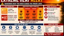
The cooler air mass will also provide a welcome break from the extreme heat that pushed temperatures into the 90s across parts of the region. Overnight lows are expected to remain comfortable, especially in rural valleys where temperatures may dip into the 50s.
Thunderstorm chances increase Thursday
Attention then turns to Thursday, when a warm front is expected to move north through New York State.
As warmer and more humid air returns, the Finger Lakes will see increasing chances for showers and thunderstorms throughout the day. Forecast discussions indicate that the timing and exact placement of the warm front will determine how widespread the rainfall becomes, but confidence is growing that much of the region will experience periods of unsettled weather.
Meteorologists in Binghamton note that some thunderstorms Thursday afternoon and evening could become strong or severe. While cloud cover may limit instability, atmospheric wind shear is expected to be favorable for organized storms. Damaging wind gusts appear to be the primary concern, though forecasters say a brief tornado cannot be ruled out if sufficient instability develops.
Residents planning outdoor events, travel, or recreational activities Thursday should monitor updated forecasts as details become clearer.
 Louisiana Meteor Fireball Lights Up the Early Morning Sky Across the Southern United States
 Additional rounds of showers possible Friday and Saturday
The unsettled pattern is expected to continue beyond Thursday.
National Weather Service forecasters say another upper-level disturbance could trigger additional showers and thunderstorms Friday, particularly during the afternoon and evening hours when daytime heating is strongest.
Forecast confidence decreases somewhat heading into Saturday, but several weather models continue to suggest at least scattered showers and thunderstorms across portions of the Finger Lakes and Southern Tier. The extent of weekend rainfall will depend on the track of additional disturbances moving through the Great Lakes and Northeast.
While widespread washouts are not anticipated at this time, residents should expect periodic interruptions to outdoor plans from Thursday through Saturday.
Heat and humidity likely return for the weekend
Looking beyond the immediate storm threat, forecasters expect temperatures to climb steadily through the weekend and into early next week.
Widespread highs in the 80s are expected, with some locations potentially reaching the lower 90s. Humidity levels will also increase as dew points rise into the 60s, creating a noticeably more muggy feel across the Finger Lakes.
The combination of warmer temperatures and increasing moisture will keep the atmosphere favorable for additional thunderstorm development, although the timing of any individual storm systems remains uncertain this far out.
For now, Finger Lakes residents can expect a brief stretch of pleasant weather through Wednesday before a more active summer pattern returns for the second half of the week.

FingerLakes1.com is the region’s leading all-digital news publication. The company was founded in 1998 and has been keeping residents informed for more than two decades. Have a lead? Send it to news@fingerlakes1.com.