


The Fourth of July weekend will start dangerously hot across the Finger Lakes and Central New York, then turn increasingly unsettled as rounds of thunderstorms move through the region.
 Southern Ontario Storm Warning Damaging Weather System Could Bring Tornado Risk on Thursday
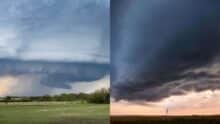
 An Extreme Heat Warning remains in effect until 8 p.m. Friday for much of Central New York and the Finger Lakes, including Yates, Seneca, Schuyler, Steuben, Tompkins, Cayuga and Onondaga counties. A Heat Advisory remains in effect for parts of the western Finger Lakes and Lake Ontario plain, including Monroe, Wayne and Ontario counties.
Heat index values will reach the upper 90s to around 105 degrees Friday afternoon, with some areas staying uncomfortably warm into the evening. The heat will ease gradually over the weekend, but humidity, thunderstorms and heavy downpours will keep outdoor plans weather-dependent through early next week.

Friday’s weather
Today will feature the worst combination of heat and storm risk.
Highs will climb into the low and mid 90s across lower elevations, but the humidity will make it feel much hotter. Heat index values will push close to 100 degrees in many communities and may reach 105 in some spots.
That level of heat can become dangerous quickly, especially for people without air conditioning, outdoor workers, athletes, older adults, young children and pets. Outdoor events should build in shade, water breaks and a way to get inside.
Thunderstorm chances will increase during the afternoon and evening as a weak cold front begins sagging south through the region. Storms will not hit everyone at the same time, but several clusters may develop and move across the area.
The strongest storms Friday could produce damaging wind gusts, torrential downpours, frequent lightning and isolated hail. The highest risk window will run from early afternoon through early evening, though timing will vary by location.
Any holiday travel, boating or outdoor setup work should be done with a close eye on radar. These storms could form quickly and turn a hot, sunny afternoon into a dangerous situation in a short period of time.
Fourth of July outlook
Saturday will still feel hot and humid, but temperatures should start trending down a few degrees compared with Friday. Highs will likely reach the 80s to low 90s, with the muggiest conditions hanging on across the Southern Tier, Finger Lakes and Central New York.
The main concern for July Fourth will be another round of showers and thunderstorms along the same frontal boundary. Storm coverage may again increase during the afternoon and evening, which is not ideal timing for cookouts, lake plans, parades or fireworks.
The severe weather threat looks more limited than Friday, mainly because clouds and earlier showers could cut into instability. Still, any stronger storm Saturday could produce gusty winds, heavy rain and frequent lightning.
That means fireworks plans are not a washout, but they are not a lock either. Communities with evening fireworks will need to watch for scattered storms and delays, especially if storms linger after sunset.
The practical takeaway: Saturday will not rain all day everywhere, but it will be the kind of day where plans need flexibility. Keep phones charged, know where shelter is, and do not wait near open fields, beaches or docks if thunder is nearby.
Sunday brings some improvement, but not a clean break
Sunday should bring more typical midsummer temperatures as the worst heat shifts away from the region. Highs will generally settle into the 80s, and humidity should ease somewhat compared with Friday and Saturday.
 New York City Extreme Heat Warning Issued Through July 4 Weekend Here's What Residents Should Know
 That said, the pattern will remain unsettled. A frontal boundary near or south of the region will keep the door open for additional showers and a few thunderstorms.
Rain chances may be highest across the southern half of the region, especially closer to the Southern Tier and Central New York. Areas farther north and west may get longer dry breaks, but the overall setup still favors scattered rain chances at times.
For outdoor plans, Sunday looks more manageable than Friday or Saturday. It will not be perfectly dry, but the heat should be less intense, and storms may be more scattered.
Boaters on Lake Ontario should also watch the wind shift. Northeast winds may increase by Sunday as high pressure builds north of the region and the frontal boundary settles south. That could create a moderate chop along the south shore of Lake Ontario.
Early next week turns wetter and cooler
The forecast takes a more noticeable turn Monday into Tuesday as low pressure develops near the stalled front and moisture surges north into New York.
This setup could bring several rounds of rain and locally heavy downpours to the Finger Lakes and Central New York. Forecast guidance shows a stronger signal for widespread rainfall, with many areas potentially seeing 1 to 3 inches from Monday into Tuesday.
That does not mean every location will see the same amount. The heaviest rain will depend on where the low tracks and where bands of downpours set up. But the pattern supports a more widespread and soaking rain than the scattered storms expected during the holiday weekend.
Temperatures will trend cooler early next week because of clouds, rain and an easterly to southeasterly flow. Highs may stay below typical early July levels, especially Monday if rain becomes widespread.
Localized poor drainage flooding will be possible if heavy downpours repeat over the same areas. Creeks, urban streets and low-lying spots will be worth watching, especially after multiple rounds of rain.
What to watch
The biggest weather issues over the next five days are heat on Friday, storm timing Friday and Saturday, and the potential for heavier rain Monday into Tuesday.
Friday is the highest-risk day for dangerous heat and stronger thunderstorms. Saturday brings a lower but still meaningful thunderstorm risk during a busy holiday period. Sunday looks more forgiving, but not completely dry.
Monday and Tuesday could bring the most widespread rain of the entire stretch.
The holiday weekend will not be a total washout, but it will require some patience. The safest approach is to treat each day as usable at times, but not guaranteed dry from start to finish.
For the Finger Lakes and Central New York, the pattern is shifting. The brutal heat is close to breaking, but the tradeoff will be repeated chances for storms and a wetter start to next week.

FingerLakes1.com is the region’s leading all-digital news publication. The company was founded in 1998 and has been keeping residents informed for more than two decades. Have a lead? Send it to news@fingerlakes1.com.