

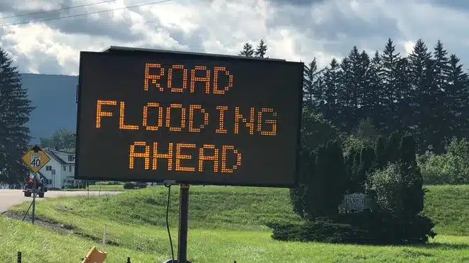
Repeated showers and thunderstorms are expected to settle over the Finger Lakes and Central New York on Sunday, with the wettest stretch likely from the western Finger Lakes toward Lake Ontario as a slow-moving front stalls over the region. A Flood Watch is now in effect from 10 a.m. Sunday to 2 a.m. Monday for parts of western and north-central New York, including some communities on the western side of the Finger Lakes, where repeated downpours could produce localized flash flooding.
The broader five-day pattern stays active, but not every day will be dominated by rain. Conditions should gradually improve from west to east on Monday, a drier break is expected Monday night through Tuesday, and then a warmer, more humid stretch with daily shower and thunderstorm chances returns from Wednesday into Friday.

Rain and storms build through Sunday night
Sunday's setup is being driven by deep southerly flow pushing Gulf moisture north into New York ahead of a wavy cold front. Forecasters in Buffalo said that boundary will become the focus for heavy showers and thunderstorms through the day and evening, with enough moisture and lift in place for repeated rounds of rain to develop over some of the same locations.
That repeated storm track matters most from the Genesee Valley into the Lake Ontario corridor, where the Buffalo office said basin-average rainfall of 1 to 2 inches is possible near the heaviest axis and localized totals above 3 inches cannot be ruled out. Urban and poor-drainage flooding is the main concern, especially where storms backbuild or train rather than moving steadily through.
For the Finger Lakes, that places the more substantial flood signal closer to the western lakes, Rochester area and northward toward the lake plain, while the rest of the region still faces a damp, unsettled day with showers, embedded thunderstorms and bursts of heavier rain. The National Weather Service has not posted a flood watch for the Binghamton forecast area, but that office also expects showers and a few thunderstorms to spread across Central New York and the Southern Tier today through Monday.
Binghamton forecasters said the heaviest rain concern on their side of the region is focused farther southeast, especially toward the southern Catskills and Poconos overnight into early Monday. Even so, the Finger Lakes and Central New York will be dealing with a saturated air mass, scattered to numerous showers and enough instability for intense rainfall rates in stronger cells.
Dry periods are still possible this afternoon and early evening, particularly across parts of Central New York and the Southern Tier, where the Binghamton office said the rain may be more broken at times before the next wave arrives tonight. That means Sunday is unlikely to be a wall-to-wall washout everywhere, but it is also not a day with much margin once heavier storms begin redeveloping.
Heaviest rain shifts tonight, then exits Monday
Another wave of low pressure is expected to move along the front Sunday night, helping push the core of the higher moisture east across the region. Buffalo forecasters expect heavy showers and thunderstorms to continue tonight, with the localized heavy-rain threat extending from the Genesee Valley toward the eastern Lake Ontario region before the system begins to pull away.
In the Binghamton forecast area, confidence is lower on exactly where the most concentrated rain sets up overnight, but the office said the ingredients for intense rainfall rates and training cells will be in place. That is one reason forecasters continue to describe the flash-flood threat as localized rather than widespread across the southeastern half of the region.

Monday does not begin dry everywhere. Showers and a few thunderstorms are expected to linger into at least part of the day, with the slow-moving front taking until Monday afternoon or evening to clear Central New York and the Southern Tier. Areas east of the Finger Lakes, including toward Syracuse and the higher terrain, may hold onto clouds and periods of rain longer than places farther west.
The improvement should work from west to east. Buffalo expects drier air to begin filtering into western New York first, while Binghamton said a northwest wind shift later Monday will help usher the front out and bring a more noticeable change by late day and Monday night.
Brief dry break Tuesday
High pressure is forecast to build in Monday night and hold through Tuesday, giving the region its cleanest break in the short-term forecast. Both forecast offices point to that stretch as the one more reliable window for dry weather after the weekend system finally departs.
Tuesday should not be especially cool, but it does look quieter. The larger point in the forecast is that the atmosphere resets only briefly before moisture starts pushing back north again, so the drier period is expected to be real but short-lived.
Humidity returns by midweek
The next shift begins Wednesday, when shower and thunderstorm chances return as another upper-level trough settles into the Great Lakes and southerly flow starts drawing more moisture back into New York. Forecast confidence is lower on the day-to-day timing here than it is with Sunday's rain, and both offices emphasize that uncertainty.
What does look more consistent is the broader pattern. Binghamton expects dew points to climb into the mid-60s to mid-70s from midweek into late week, which should make conditions feel noticeably more humid, while afternoon highs generally reach the upper 70s to mid-80s.
Buffalo's outlook carries the higher storm chances in the afternoon and evening from Wednesday through Friday, but forecasters there also note that confidence remains low on exact timing and intensity. In other words, the region looks headed back into an unsettled summer pattern rather than toward a single clearly defined storm day at this point.
That means the second half of the workweek may include several rounds of showers and thunderstorms separated by dry periods, with the sharper details likely to come into focus once the current front clears the region and the next Great Lakes trough approaches.

Check the latest forecast at the FingerLakes1.com Weather Center.

FingerLakes1.com is the region’s leading all-digital news publication. The company was founded in 1998 and has been keeping residents informed for more than two decades. Have a lead? Send it to news@fingerlakes1.com.