


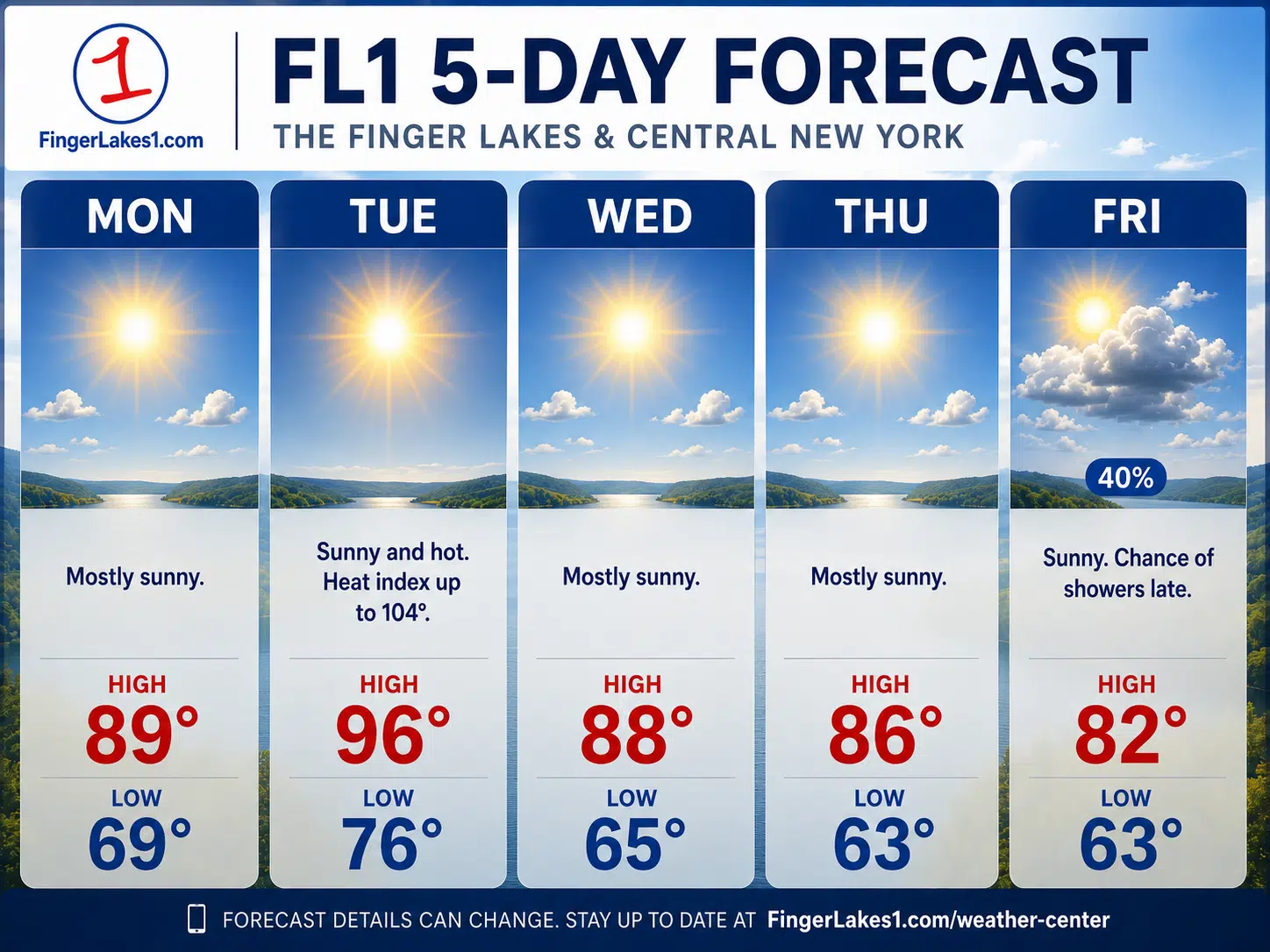
The Finger Lakes starts the new work week under a Heat Advisory that now covers Cayuga, Ontario, Schuyler, Seneca, Tompkins, Wayne and Yates counties through 8 p.m. Tuesday, with temperatures climbing into the upper 80s and lower 90s today before even hotter air arrives Tuesday.

National Weather Service forecasters in Buffalo and Binghamton both point to the same broad setup: a strong midsummer ridge building over the Great Lakes and central New York, a mostly dry pattern for much of the next several days, and Tuesday as the day with the highest risk for dangerous heat, especially away from the immediate lake influence and in the warmer valleys south of the Thruway.

Today’s weather

Monday begins quietly across, and for most the first part of the forecast is straightforward. Skies should stay mostly sunny from Auburn and Seneca Falls east through Ithaca and south toward Watkins Glen, while afternoon temperatures rise to about 88 to 90 degrees in Geneva, Newark, Penn Yan, Seneca Falls and Auburn, closer to 89 in Canandaigua and around 91 to 92 in Ithaca and nearby southern valleys.
The reason the advisory is already in effect even though Monday is not the hottest day is that the region is starting a two-day heat event, not just a one-afternoon spike. Heat impacts build over time, and the official forecasts show many communities staying unusually warm Monday night, with lows only falling back into the upper 60s and lower to middle 70s. That kind of limited overnight relief matters for homes without air conditioning, older adults, and anyone working or practicing outside again on Tuesday.
There is a small but real wrinkle in the Monday forecast for the southern Finger Lakes. Binghamton forecasters added a slight chance of thunderstorms this afternoon as a weak disturbance drops in from the Great Lakes, and point forecasts for parts of Ontario County and the Bristol Hills also show only a low-end chance of a late-day shower or storm. That does not look like a widespread rain event, and most towns should stay dry, but Schuyler, Tompkins and nearby higher terrain should keep outdoor plans a little flexible late in the day.
Why Tuesday matters more
Tuesday is the day this forecast turns from ordinary July heat into something more serious. The Buffalo forecast discussion says the Finger Lakes region is likely to see the hottest conditions of the stretch Tuesday, with highs in the low to mid-90s and heat index values ranging from the mid-90s to low 100s. Binghamton is even more aggressive on the upper end of the temperature potential and says some locations in central New York could push into the upper 90s or briefly flirt with 100 if the hottest air mixes down efficiently.
The official city forecasts support that message across the core FL1 counties. Auburn is forecast near 95 on Tuesday with a heat index around 101. Geneva, Seneca Falls and Watkins Glen are forecast in the mid-90s, Newark near 96 with heat index values around 105, Penn Yan near 94, and Ithaca close to 98 with a heat index near 105.
That is enough to create a meaningful heat risk even without an all-time-record setup. The biggest practical concern is not just the afternoon peak, but how broad the hot zone looks across the Finger Lakes. This is not a forecast where only one or two valley communities get hit while the rest of the region escapes. Lake Ontario may trim conditions slightly in parts of northern Wayne County and the far northern fringe of Cayuga County, but the overall pattern still supports dangerous midsummer heat in all of FL1’s primary counties.
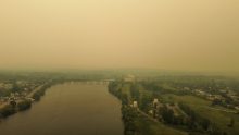
Forecast uncertainty remains, but it is the kind of uncertainty that fine-tunes the numbers rather than cancels the event. Binghamton noted that smoke from Canadian wildfires could limit solar heating enough to shave a degree or two off the warmest spots Tuesday. Even if that happens, the advisory-level setup remains intact because humidity, warm overnight lows and several hours of afternoon heat still create the same public-health concern.
Wind, humidity and lake impacts
One part of the forecast that could surprise people is the wind on Tuesday. Buffalo forecasters expect a tightening pressure gradient and stronger southwest to west-southwest flow, with gusts of 25 to 35 mph possible in and downwind of the lakes. That wind may offer some natural relief at times, but it will not cancel the heat, and it can create a false sense that conditions are safer than they really are.
For boaters and lake communities, that matters in two ways. First, hotter weather usually brings heavier use on Canandaigua Lake, Seneca Lake, Keuka Lake and the eastern Lake Ontario shoreline near Wayne County. Second, stronger afternoon wind can make open-water conditions choppier even on a day without storms. Anyone heading out on the water Monday gets the better window, while Tuesday looks more uncomfortable and somewhat rougher.
Humidity is also part of the story, though not every community will feel it the same way. Monday’s heat should still be more manageable in places where mixing keeps the air from turning oppressively sticky. By Tuesday, that margin shrinks, and several official forecasts in the Finger Lakes now show heat index values crossing 100 degrees. That is the threshold where camps, crews, athletes, festival organizers and farm operators should start adjusting schedules instead of simply reminding people to bring water.
The five-day outlook
Monday is hot, mostly dry and increasingly uncomfortable by late afternoon. Most communities should be able to use the day for travel, construction, fieldwork and lake plans, but the better outdoor window is morning through midafternoon, before the warmest temperatures and the small chance of a late-day storm in the southern Finger Lakes.
Tuesday is the peak-impact day. Highs should run from the middle 90s to upper 90s across much of the region, with the hottest readings most likely in inland valleys and the southern half of the coverage area. The Heat Advisory runs through 8 p.m. Tuesday, and Tuesday night stays warm enough that many homes will not cool quickly once the sun goes down.
Wednesday still looks hot, but it should be a step down from Tuesday rather than a second full escalation. Current NWS forecasts put Auburn near 89, Geneva around 88, Newark near 88, Penn Yan about 89, Watkins Glen near 91 and Ithaca close to 92. That is still solidly above normal for mid-July, but it suggests the sharpest edge of the heat begins to ease after Tuesday.
Thursday looks more seasonable and more usable. Highs are generally forecast in the mid-80s to upper 80s, with more comfortable overnight lows returning by early Friday. The broader pattern also stays mostly dry, which should help communities catch up on outdoor work that is harder to handle during the hottest part of the week.
Friday currently looks like another workable midsummer day for most of the Finger Lakes, with highs mostly in the lower 80s to middle 80s. There is some lower-confidence signal for a shower or thunderstorm to reenter parts of the southern Finger Lakes later in the week, especially around Ithaca, but that risk is nowhere near as clear or immediate as the heat story at the front of this forecast.

FingerLakes1.com is the region’s leading all-digital news publication. The company was founded in 1998 and has been keeping residents informed for more than two decades. Have a lead? Send it to news@fingerlakes1.com.