

The greatest threat for severe weather is now behind most of us in the Finger Lakes.

While it will remain breezy tonight, and a rogue shower or downpour cannot be ruled out, most will see clearing skies as sunset approaches.
There will be another threat for thunderstorms tomorrow, but the risk for severe weather will be significantly less.
Editor’s Note: If you’re looking for photos and coverage from Monday’s severe weather outbreak, scroll down below today’s forecast information.
Live Local Radar

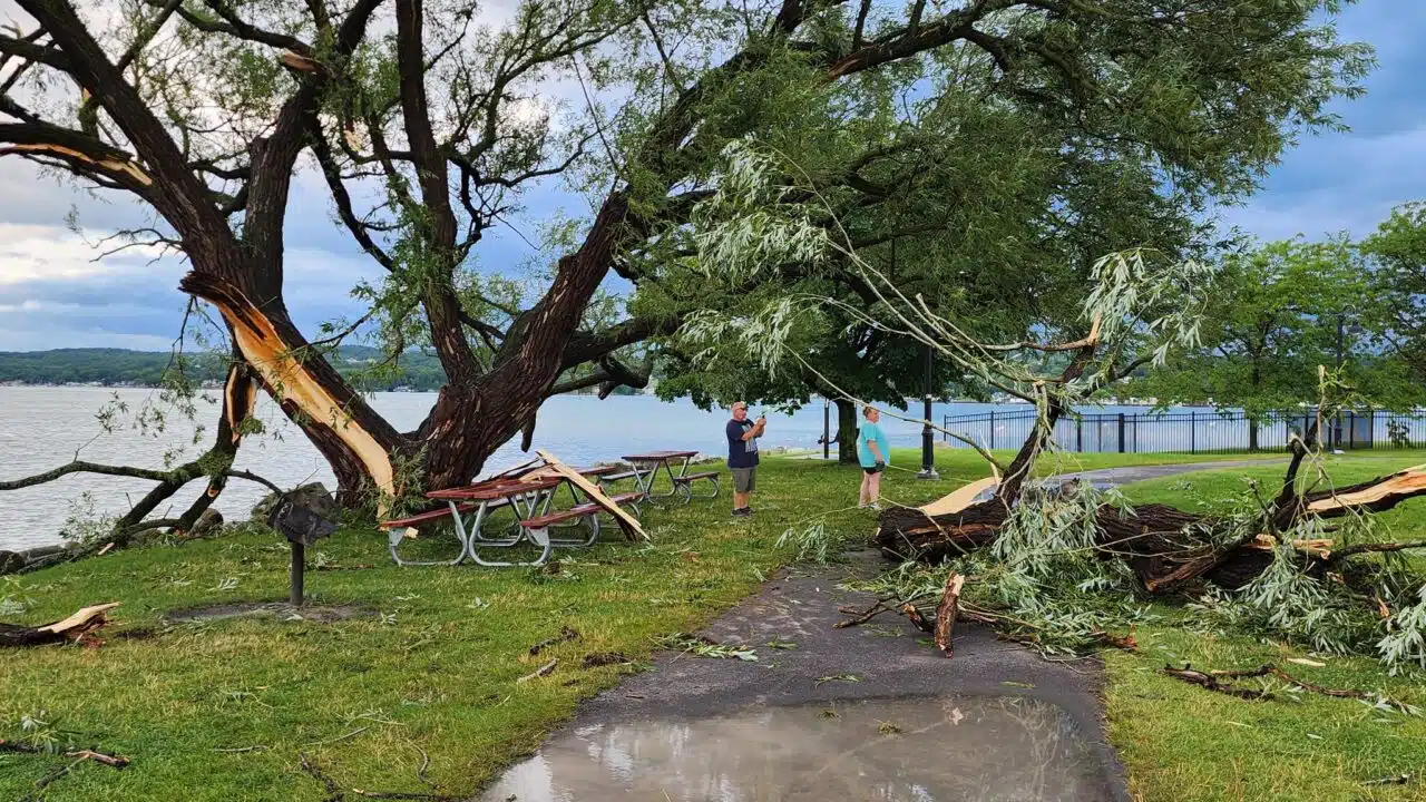
Severe thunderstorms leave trail of destruction through the Finger Lakes: Thousands without power as Tuesday begins
Severe thunderstorms packing damage winds and large hail moved through the Finger Lakes and Southern Tier Monday afternoon. There may have even been a tornado in Ontario County, but the National Weather Service hasn’t yet confirmed those reports.

The winds took down trees and power lines, while the hail was large enough to cause damage of its own, too.
One of the cells that moved through the central portion of the Finger Lakes even carried a tornado warning with it. At this point, the National Weather Service hasn’t confirmed anything, but damage reports were streaming in throughout the evening.
As of 4 a.m. power outages in Ontario and Wayne counties were reduced to a few hundred. However, more than 1,000 were without power still in Cayuga County; 4,000+ were without power in Schuyler County (representing roughly 50% of all households there); over 8,500 in Steuben County; over 4,000 in Tompkins; and a couple hundred in Yates County.
Restoration times varied throughout the day on Tuesday.
 New York City Extreme Heat Warning Issued Through July 4 Weekend Here's What Residents Should Know


MORE FROM SOCIAL
Video taken by Deb Davis of hail coming down hard in Farmington, NY @NWSBUFFALO pic.twitter.com/E4XAsfi61V
— Kayla (@kayla_wx_lewis) July 15, 2024Also readSouthern Ontario Storm Warning Damaging Weather System Could Bring Tornado Risk on Thursday
FingerLakes1.com is the region’s leading all-digital news publication. The company was founded in 1998 and has been keeping residents informed for more than two decades. Have a lead? Send it to news@fingerlakes1.com.