


Here comes the bitter cold for the Finger Lakes and Central New York regions.
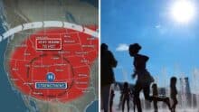 Western US Heat Dome Brings Dangerous Temperatures as Extreme Heat Arrives Before Monsoon Season
 This won’t be the first Arctic blast of the season, but some places could see the coldest temperatures recorded in 5-6 years.
Most of the region is currently rebounding from overnight lows that dipped to around zero degrees. Wind chills well-below zero were reported in the Syracuse-area, including Cayuga County.

Looking ahead, temperatures will not rise much during the day- and then plummet tonight. The forecasted low temperature throughout the Finger Lakes is between -5 and -10 degrees.
That’s without the wind chill. Even though winds will be light and variable, the mere presence of wind will mean that wind chills of up to -20 to -25 are possible in places.
The bottom line: If you’re going to be outside use extreme caution and dress appropriately. It takes very little time for exposed skin to become frostbitten in these conditions.
Even as temperatures rebound on Saturday and get into the low-20s, wind will keep the ‘real feel’ temperature significantly colder.
Speaking about the bitter cold Arctic air on Thursday, Governor Kathy Hochul said she was directing state resources to assist New Yorkers.
“Forecasts are calling for another round of extremely cold temperatures throughout New York over the next few days,” Hochul said. “These conditions can be very dangerous if not taken seriously, so now is time to prepare. Be sure to limit time spent outdoors, know where to take shelter and as always, check on friends and family, if possible, to ensure their safety.”
MORE LOCAL WEATHER RESOURCES
– ACTIVE ALERTS FROM NATIONAL WEATHER SERVICE
– LATEST FORECAST FROM STORM TRACKERS TEAM
– FINGERLAKES1.COM WEATHER CENTER
Frigid weather into the start of the weekend with some areas below zero Saturday AM. Snow showers develop on Sunday and a little light snow possible next Tuesday but no big storms in sight…and no real warm-up in sight either. Updates on News10NBC Today pic.twitter.com/WtXRczbEix
— news10nbc (@news10nbc) January 21, 2022
Temperatures will remain below average for much of the next week. Temperatures the week after that are expected to be warmer. On the graphs, the dotted lines are the average high and low temperatures. On average the end of January is the coldest time of year. #pawx #nywx pic.twitter.com/wQa2VfIicM
— NWS Binghamton (@NWSBinghamton) January 21, 2022
Many of our lakes, ponds, streams and smaller rivers have developed a layer of ice with our recent (and continued) cold period. Here is an eye-opening reminder if you or your loved-ones are planning to recreate on or near frozen bodies of water. #ColdWaterFact #nywx #pawx pic.twitter.com/zx5cRJSP1v
— NWS Binghamton (@NWSBinghamton) January 20, 2022
Ice pillars are out to play tonight! This phenomenon is the result of suspended ice crystals in a very cold atmosphere reflecting light. This creates the illusion of vertical pillars extending toward the heavens. Great shot by Josh & Mark Gebhardt in Ogden. pic.twitter.com/RzKh11m1nw
— Eric Snitil (@EricSnitilWx) January 21, 2022
FingerLakes1.com is the region’s leading all-digital news publication. The company was founded in 1998 and has been keeping residents informed for more than two decades. Have a lead? Send it to news@fingerlakes1.com.