A Cornell University scientist will help a NASA-led research campaign measure snowfall on fast-changing Arctic glaciers, data researchers need to improve projections of future sea-level rise.
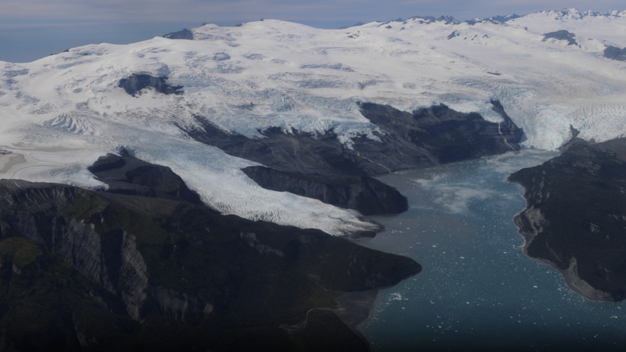
Riley Culberg, an assistant professor of earth and atmospheric sciences at Cornell, has joined the science team for Snow4Flow, a five-year airborne mission led by the University of Arizona. The project will survey glaciers in Alaska, the Canadian Arctic Archipelago, Svalbard and southeastern Greenland, according to a Cornell Chronicle announcement.

The project involves scientists from 12 U.S. universities and NASA. Aircraft surveys are expected to begin in spring 2027 and continue through 2029, followed by about two years of analysis. Field teams will take measurements on selected glaciers while the aircraft collect data overhead.
NASA's Snow4Flow mission page says the campaign is designed to measure snow accumulation, ice thickness and glacier elevation. Meltwater from glaciers outside the vast Greenland and Antarctic ice sheets accounts for more than 20% of current sea-level rise, NASA says, but many of those glaciers remain poorly measured.
Measuring snowfall beneath the surface
Much of Culberg's work will focus on the snow that accumulates on glaciers each year. A high-frequency radar aboard the aircraft will image roughly the upper 10 to 15 meters of ice and snow, revealing layers associated with successive winters.
Researchers hope to use the thickness of those layers to estimate how much new snow fell. Depth alone is not enough: snow density changes with temperature, wind, snowfall history and compaction, so a deep layer does not always represent the same amount of water.
Ground crews will drill snow cores, dig pits and make other measurements to help calibrate the airborne observations. In some places, drones carrying radar will collect data at a scale between the ground measurements and the aircraft surveys.
Gili Kurtser Gilead, a doctoral student in Culberg's group, is analyzing older radar observations and building a process for identifying snow layers. The team expects the new measurements to help turn radar images into estimates of snow mass.
From flight lines to glacier-wide estimates
The aircraft will also carry a laser altimeter and other radar systems to measure ice thickness and the shape of the terrain beneath glaciers. Culberg is working with scientists at Georgia Tech and the University of Florida to turn measurements along individual flight paths into estimates for whole glaciers.
Those broader estimates can be combined with satellite observations and computer models to project glacier changes through the end of the century. The first flights are expected in late April 2027, with Culberg's group potentially receiving processed data that summer. Further campaigns are planned for spring 2028 and 2029.
Culberg previously used data from NASA's Operation IceBridge, which ended in 2019. Snow4Flow will collect new measurements with near-surface snow conditions as a primary goal, rather than treating them as a secondary finding from equipment focused on total ice thickness.
The work is technically difficult. Radar signals can reflect off steep valley walls, while crevasses and sharp changes in snowfall can make annual layers harder to identify. Culberg expects those obstacles to require improvements in both radar observations and data processing.
The mission has not yet produced new glacier measurements or sea-level projections. Its planned surveys are meant to give scientists firmer starting data for estimating how smaller, rapidly changing glaciers may contribute to future sea-level rise.

FingerLakes1.com is the region’s leading all-digital news publication. The company was founded in 1998 and has been keeping residents informed for more than two decades. Have a lead? Send it to news@fingerlakes1.com.