

The National Weather Service confirmed that an EF1 tornado, with winds reaching up to 90 mph, touched down in areas of Tompkins and Cortland Counties on Monday afternoon.
The tornado made its first appearance at 5:13 p.m. near the intersection of Route 38 and Purvis Road in eastern Tompkins County, before cutting a path 11 miles north-northeast, finally dissipating near the Tioughnioga River, south of McGraw.
The storm’s most significant impact was felt near Clute Road in Virgil, where numerous trees were uprooted or snapped, and a large store building suffered partial roof damage. Additional damage, primarily involving downed trees, was reported along Stafford and West River Roads. The tornado eventually lifted at 5:36 p.m., leaving a trail of destruction in its wake.
Check out video shared to Twitter by Mandy Qualls:
The severe weather threat has passed for the Finger Lakes region, but parts of the region will be cleaning up after damaging winds were reported within some storms.

AFTERNOON UPDATE: Thunderstorms expected to fire up within hours across Finger Lakes
Abundant sunshine late this morning and during the early-afternoon hours is setting up for what forecasters discussed this morning.
The National Weather Service has issued a Tornado Watch for parts of Ohio and Pennsylvania. This is significant given that this area of activity is moving northeast toward Western and Central New York.
The timeframe to watch for looks to be between 4 p.m. and 7 p.m. Thunderstorms will develop in the Southern Tier and push northeast through the afternoon.
While no severe thunderstorm watch has been issued yet, it’s entirely possible for one to be issued within the next two hours.
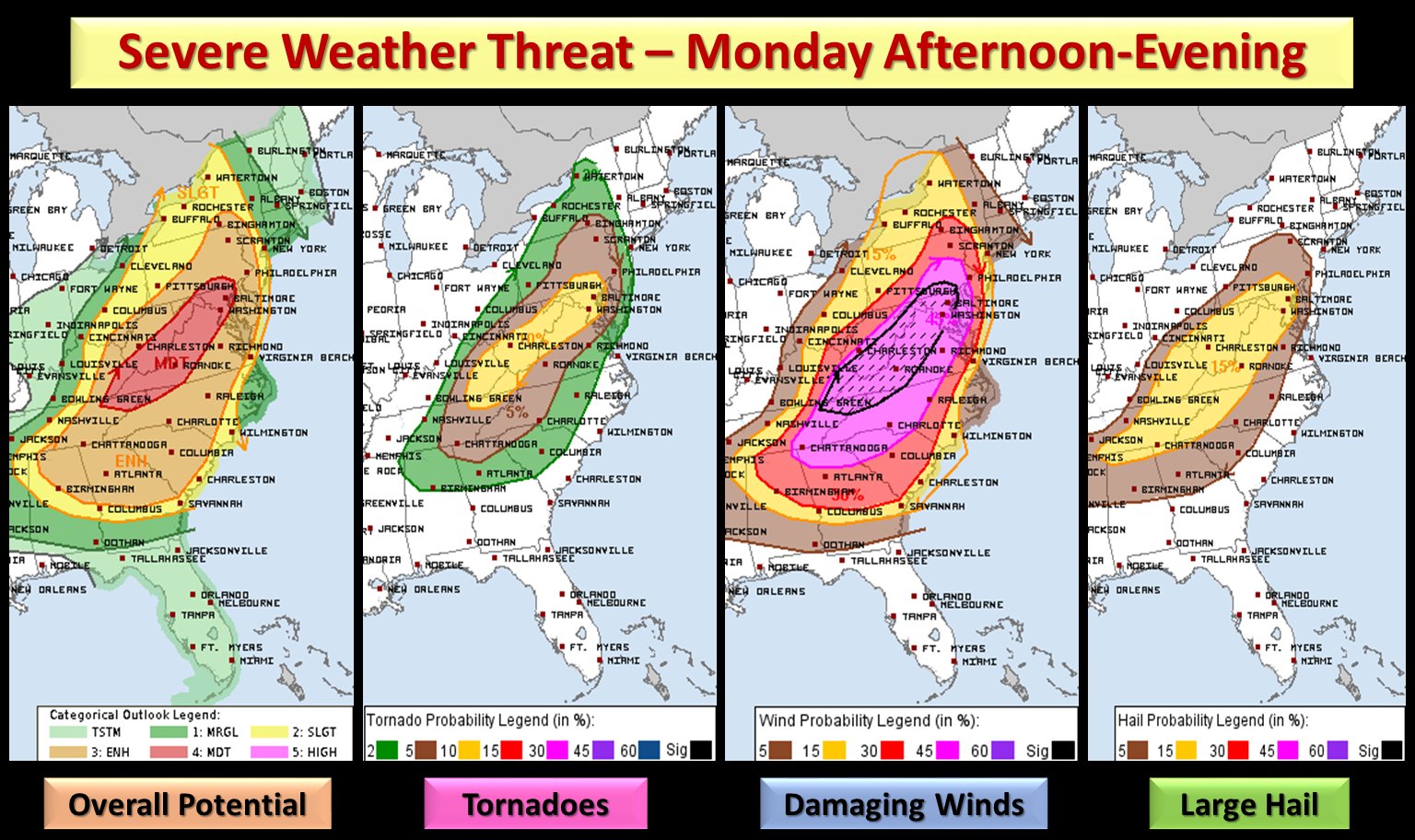
MORNING UPDATE: Severe weather risk elevated this afternoon across Finger Lakes, Central New York
The risk for severe weather will be on the rise today across the Finger Lakes and Central New York.
According to the National Weather Service, the greatest risk will be in the eastern portion of the region. However, storms will brew as late-morning clearing gives way to an atmosphere ripe for thunderstorm development.

Does it mean you should cancel your outdoor plans for Monday? Absolutely not. However, forecasters are watching the afternoon window – between 12 p.m. and 8 p.m. as the time for development.
If a Severe Thunderstorm Watch were to be issued, it would not be unexpected.
In addition to the threat of hail, frequently lightning, and damaging winds with these storms – flash flooding is also a concern.
However, all of this will be highly-localized. Pay attention to local forecasting, and if you hear thunder – head indoors.

Local Radar
FingerLakes1.com is the region’s leading all-digital news publication. The company was founded in 1998 and has been keeping residents informed for more than two decades. Have a lead? Send it to [email protected].