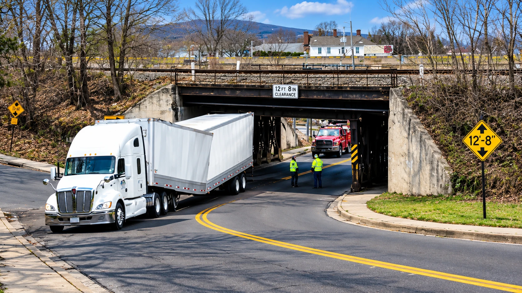
New York has renewed efforts to address low-clearance bridges. In 2026, the state added warning systems and improved fines for violations to address the bridge-crossing problem in Onondaga County. Penalties were also increased in New York State for commercial vehicles striking bridges.
For the commercial driver using the interstate highway system in Central New York and the Finger Lakes, most bridge strikes can be avoided if proper consideration is taken prior to commencing the trip. Commercial vehicle drivers should take the time to understand load restrictions and route restrictions, and find an appropriate route for the vehicle being transported.
What New York Changed in 2026
In February 2026, New York completed safety improvements along the Onondaga Lake Parkway in Onondaga County. Changes included the following:
- Upgraded vehicle detection system: Two sets of sensor vehicles were added in each direction to positively confirm when an overheight vehicle approaches the bridge and trigger a warning.
- New warning signs: The signs light up and display a “No Truck” warning when an overheight vehicle is detected. The signs are placed 750 feet and 950 feet, respectively, from the bridge, in the eastbound and westbound directions.
- New message boards: Two permanent, full-color electronic message boards were placed along the parkway, and warning signs are activated when an overheight vehicle is detected.
- Eight-point driving-record penalty: Beginning February 16, 2026, all violations for commercial vehicles striking a bridge, and for other commercial overheight vehicles, became an eight-point driving record offense.
The planned changes will utilize technology to help bridges detect, provide warnings, and increase the penalty structure to help curb strikes. Changes on the Onondaga Lake Parkway will address one circumscribed case. Throughout the rest of New York State, commercial drivers will still have to verify their vehicle heights, consider clearance restrictions, and plan routes to ensure strikes do not occur.
Difficulties Caused by Low Bridges
Roads built to handle regular cars generally cannot handle larger commercial vehicles. A navigation route can easily lead a truck to a low railroad bridge or a height-restricted overpass. Drivers often don’t recognize these restrictions until they see a sign, and by that point it’s too late.
Last-minute route changes, along with construction and detours, can lead to drivers using local roads they are unfamiliar with. These local roads can have different clearance limits and restrictions. Turning a large truck around, or just finding a safe route to take in a congested area, can be extremely challenging.
Accounting for all of these factors when doing route planning can be very difficult. Drivers often just consider how tall their vehicle is in relation to signs along the route and do not take into account other clearance issues along their route or other restrictions.
How Drivers Can Avoid Low-Clearance Bridges
To prevent a bridge strike, you need to know how high your entire vehicle will be. All drivers are responsible for determining the approximate total height of their vehicles prior to departure. Adjustments may have been made to equipment or cargo that could affect the overall height. If an estimate is made and it’s lower than the actual height of the vehicle and there is limited vertical clearance at the bridge, then this creates a serious safety concern.
Route planning and evaluation are equally important. The route you choose to drive on initially will change. So it’s also very important to evaluate again if the road changes. A route you may think will work for you in the beginning could be blocked by restricted roads, or you may come across low-clearance bridges requiring another way.
Drivers can take a few practical steps to reduce these risks:
- Verify truck dimensions: Verify the total truck height, including the trailer and cargo prior to departure.
- Review bridge clearances: Determine if there may be any low bridges or tunnels along your intended route.
- Verify road restrictions: Confirm that the routes you have chosen are acceptable for use by commercial trucks.
- Determine alternative routes: Prior to taking a detour, determine what is the maximum allowable clearance limit and any specific truck restrictions.
- Heed all posted warning signs: DO NOT PROCEED through an intersection simply based upon directions from your GPS if you are in doubt as to whether or not you will be able to clear the intersection.
How Truck-Specific Navigation Helps With Route Planning
Trucker Guide provides more than just a truck-specific GPS. It has a low clearance map that includes over 17,000 bridges/tunnels in the US. Drivers are able to look at low-clearance areas in different states as well as check the height limits for their intended route prior to departure.
Additionally, the map links drivers with more than 450,000 truck-friendly points of interest (POI). These POIs will assist drivers in finding places to purchase fuel, find parking, etc., while on the road.
The app has multiple ways to plan a route, including up to three routes for a driver to choose from, along with displaying the cost of tolls prior to the start of the trip. The option of selecting alternative routes provides drivers with choices rather than having the app automatically suggest only one.
In addition to providing multiple routes for drivers, the app can also adjust its routing based on seasonal closures. Using data regarding the current state of roads and the size of the driver’s vehicle, the app will create a new route that avoids these seasonally restricted areas. This will help drivers anticipate potential delays in their travels.
The above-mentioned functions are especially beneficial if a driver needs to review different routes or reevaluate their trip due to a road closure. While navigation systems should assist with proper planning for each trip, drivers must verify ambiguous bridge clearances, read all of the signs on the roads that they will be traveling, and abide by the road closures that have been established by authorities.
You can plan routes by bridge clearances map to investigate potential hazards before reaching them. Checking this information in advance can help drivers make more informed route decisions and reduce the likelihood of discovering a clearance problem too late.
Why Planning Ahead Matters
A bridge strike can affect more than the driver involved. Damage to a bridge may require inspections and repairs, while road closures can disrupt freight deliveries, local traffic, and nearby businesses. Trucking operators may also face vehicle repairs, missed delivery windows, and additional costs while arranging an alternative route.
Pre-planning helps drivers identify potential problems before they become emergencies. Reviewing bridge clearances, checking restrictions, and comparing suitable routes can make it easier to respond when a trip involves unfamiliar roads or unexpected changes.
New York’s 2026 safety measures reinforce the importance of preventing bridge strikes before they happen. For commercial drivers traveling through Central New York and the Finger Lakes, knowing vehicle height, checking clearance information, and choosing routes appropriate for their trucks remain essential parts of safer and more reliable travel.

This content is brought to you by the FingerLakes1.com Team. Support our mission by visiting www.patreon.com/fl1 or learn how you send us your local content here.