
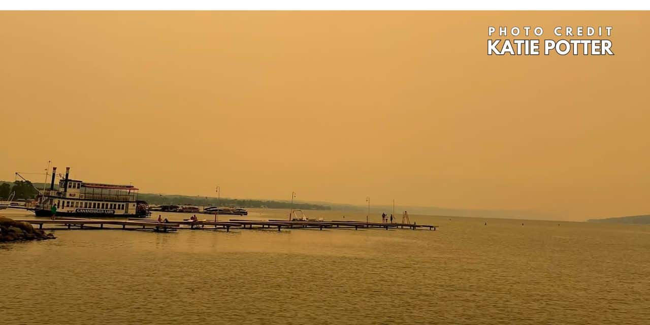
Wildfire smoke is expected to hold over the Finger Lakes and Central New York through Thursday, keeping skies milky and temperatures lower than they would otherwise be in mid-July while air quality alerts remain posted across much of the region.
The latest forecast discussions from the National Weather Service offices in Buffalo and Binghamton show the thickest smoke lingering through at least Thursday night, with the haze expected to trim daytime heating and, at times, reduce visibility near the surface before a warmer Friday gives way to a wetter, more unsettled weekend.

Smoke and a cooler Thursday
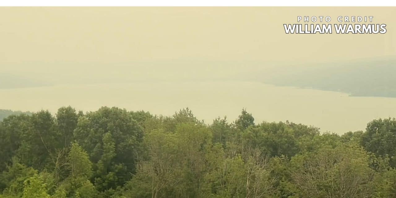
Thursday’s forecast is still centered on smoke moving east from active fires in south-central Canada and northern Minnesota, a setup both forecast offices said has already cut expected high temperatures by several degrees. Buffalo forecasters said some places could end up around 10 degrees cooler under thicker smoke, while Binghamton said the limited sunshine may keep even the revised forecast a little too warm if the haze stays dense through late morning and early afternoon.
That should leave much of the region closer to the lower 80s than the upper 80s on Thursday, with Penn Yan near 80, Rochester around 83, Syracuse near 82 and Elmira in the low to mid-80s in the latest NWS point forecasts. The broader story, though, is not a sharp west-to-east temperature split so much as how much smoke mixes down to the surface and how much sunshine is able to break through over the course of the day.
Both forecast offices also warned that visibility may fluctuate as the smoke thickens and thins. Buffalo said the greatest visibility reductions should come from Wednesday night into Thursday morning, while Binghamton said some parts of Central New York and the Southern Tier could see visibility briefly fall to around 1 to 2 miles late in the morning and through much of the afternoon before improving again during the evening.
Air quality alerts remain part of the forecast across a large stretch of the region. Buffalo’s advisory covers Monroe, Wayne, Ontario and Livingston counties along with neighboring areas to the west and north through late Thursday night, while Binghamton’s alert zone includes Yates, Seneca, Cayuga, Onondaga, Tompkins, Schuyler, Steuben and Chemung counties and nearby parts of Central New York.
Friday turns warmer before the next change
The smoke is not expected to disappear all at once on Friday, but both offices point to gradual improvement as winds turn more westerly and then southwesterly ahead of the next low-pressure system. Binghamton said less smoky air should move in later Thursday night into Friday, though some haze may still linger because smoke remains upstream over the Midwest. Buffalo also said the wildfire plume could hang on into Friday if the fires stay intense and the larger-scale flow changes little.
That means Friday looks like the transition day in the forecast. The latest NWS forecasts push highs back into the low to mid-80s across much of the Finger Lakes and Central New York, with more sunshine returning than on Thursday but still some uncertainty over how fast the smoke thins out, especially from the lakeshore inland through the Finger Lakes.
Most of Friday should stay dry, but the chance for showers starts to creep in late, first as the broader weekend system edges toward western and central New York. In the point forecasts, the first rain chances hold off until Friday night, with the better signal for any early showers or a stray thunderstorm coming after dark rather than during the daytime hours.
Saturday brings the wettest period
The weekend’s most active stretch still looks centered on Saturday and Saturday night as a fairly strong midsummer trough digs into the Northeast and an associated surface low moves through the region. Both Buffalo and Binghamton describe that period as the peak window for widespread showers and thunderstorms, with rain chances increasing Friday night and becoming much more established during the day Saturday.
Forecasters are also stressing that Saturday does not currently look like a nonstop washout. Binghamton said the region is more likely to see periods of showers and thunderstorms rather than all-day rain, but the coverage should still be broad enough to make Saturday the least settled day in the forecast from the Finger Lakes east through Syracuse and south into the Southern Tier.
Warm-sector air ahead of the cold front could also allow some storms to strengthen late Saturday into Saturday night, especially as the front moves through. Binghamton’s discussion said there is a low-end severe potential in that window, but it also pointed to limiting factors including lingering smoke, weaker midlevel lapse rates and a capped atmosphere earlier in the event. At this point, isolated strong wind gusts appear to be the main concern rather than a broader severe weather outbreak.
The temperature signal reflects that setup. Official NWS forecasts lift highs into the upper 80s on Saturday in places such as Rochester, Syracuse, Ithaca and Elmira before the front crosses, a notable rebound from the smoke-muted conditions expected Thursday.
Cooler air returns Sunday and next week stays changeable
Showers may linger into part of Sunday, especially east of the Finger Lakes and across Central New York, before drier air works in behind the front. Buffalo expects most of the weekend activity to push through with a cold frontal passage by Sunday, and Binghamton likewise says drier and cooler air moves in once the low pulls away.
That should bring highs back closer to around 80 Sunday, with a better chance for partial clearing later in the day from west to east. The current point forecasts show Rochester near 80 on Sunday, with Syracuse and Elmira closer to the upper 70s as any early showers give way to improving conditions.
The calmer stretch may not last long. Both forecast discussions point to northwest flow holding temperatures closer to seasonal levels next week, and Binghamton said passing cold fronts or shortwaves could still touch off additional rounds of thunderstorms. That keeps the forecast from turning sharply hotter after the weekend, even if Monday itself trends mainly dry with highs returning to the mid-80s in many communities.
Check the latest forecast at the FingerLakes1.com Weather Center.
Make FL1 part of your day.
Local reporting. Useful updates. More ways to stay close to your community.
Go ad-free
Support independent local reporting and enjoy FL1 without display ads.
$4.99 / month
Become a member →Cancel anytime. Third-party media players may contain ads.Get the daily briefing
Start your morning with the headlines that matter across the Finger Lakes.
Find more FL1 on Google
Choose FingerLakes1.com as a preferred source to see more of our reporting in your Google news results.

FingerLakes1.com is the region’s leading all-digital news publication. The company was founded in 1998 and has been keeping residents informed for more than two decades. Have a lead? Send it to news@fingerlakes1.com.