

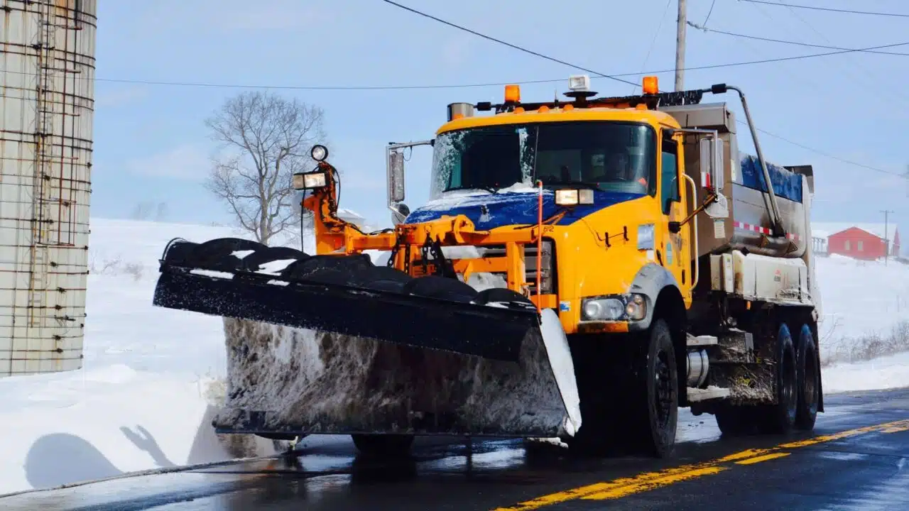
In the last week of January 2026, a Town of Canandaigua plow truck pulled up outside an elementary school in Canandaigua so that a class of second graders could see the machine that had been clearing their roads all weekend. The crew had worked around the clock through a storm that put the whole state under an emergency declaration. Forecasts called for a foot or more of snow across much of upstate New York. Highway Superintendent Jim Fletcher said the children’s excitement made the extra effort worthwhile. For people in the region, that same weekend raised a familiar question about where the plow was and when it had last come down the road.
In Rochester and Syracuse, residents answer that question by opening a map. Rochester’s PlowTrax switches on during snow events and follows roughly 150 plows by GPS. It shows where each one is and refreshes every five minutes. Syracuse runs a map that shows when every street was last cleared and marks the cars ticketed for blocking a route. The city upgraded the GPS units on its plows and added dashcams in 2021, and its chief innovation officer, Conor Muldoon, has said complaint calls have dropped by about 30 percent since. Buffalo has had a public tracker since the winter of 2022-2023, and Oneida County added its own county plows to an online map in January 2024.
None of the Finger Lakes counties discussed here offer anything like it. A check of each of these county highway departments’ websites in early November 2026 found no public plow map and no mention of GPS on county trucks.
Part of the reason may be the way the region plows. A city runs its trucks under one department, so one set of GPS units covers most of its streets. In the Finger Lakes, many counties hand much of the winter work to the towns. Livingston County contracts with all 17 of its towns to plow and salt county roads, and Ontario County’s snow removal budget is essentially a set of contracts with its 16 towns. Yates County crews plow less than half of the county’s road miles themselves and pay seven of the nine towns to cover the rest. Seven towns in Tompkins County assist on county roads, and Cayuga County pays its town highway departments to clear certain county roads as well. Steuben is an exception, running its own fleet of about 50 plows out of the county public works department. A countywide map in most of the region would therefore need GPS tracking on trucks owned by dozens of separate town governments, each with its own superintendent, budget, and board.
Oneida County ran into the same limit. Its map shows only the county’s own plows, and the county roads that towns and villages plow under contract do not appear on it.

The Finger Lakes departments run the older system instead, and it has its own logic. Yates County assigns two foremen each week to Snow Watch duty to monitor the weather and the roads around the clock and start the plowing. Sheriffs issue travel advisories county by county. Residents who want to know when a plow was last by call the highway garage, or look out the window. The county websites offer winter tips rather than maps, such as staying well back from a plow and keeping parked cars and garbage cans off the shoulder.
The technology behind the city maps is not exotic. A GPS unit on each truck sends its position over the cell network, and software snaps those points to a street map and colors each road by how long it has been since a plow passed. Buffalo’s city documents put the cost of each locator at around $265. The same vehicle location tools are sold to delivery fleets, school bus contractors, and farms. One of many companies in that market is www.gpswox.com/en, which sells software for following vehicles and trucks online.
The state already tracks its own trucks this way. Every large Thruway plow carries an enhanced GPS device that reports its route, the air and pavement temperature, and how much deicing material it is spreading. During storms, devices on 50 heavy duty plows, added in a pilot the Thruway launched in 2024, feed alerts to navigation apps, so a driver using one can get a warning that a plow is working ahead. The Thruway crosses Ontario, Seneca, and Cayuga counties, so Finger Lakes drivers on a bad night are already sharing the road with tracked plows. On state roads, the 511NY map shows whether a highway is snow covered, wet, dry, or closed based on what plow drivers report from the cab. Both tell the public about conditions, and neither agency’s public pages describe a map of where each truck is.
Cities say the payoff is for the garage as well as for residents. Managers in Rochester’s environmental services department use PlowTrax during a storm to adjust routes while the trucks are still out, and residents can click to see the group of streets each truck is assigned to. Oneida County says the same GPS units give its public works department live mechanical status on each truck. Syracuse’s experience is that the map answers complaints. When a resident calls to say the street has not been touched, the city can show the time of the last pass, sometimes only a couple of hours before fresh snow covered the work. On the fleet management side, Syracuse’s own 2022 review of the system notes that after every storm senior staff and the snow operations team ask for new measurements and tools, so the map keeps changing.
None of the county highway pages checked mention a plan for a tracker. Tompkins County did launch a single online map this year, in June 2026, but it shows the year’s road construction projects, not winter plows. In most of the region, a decision would sit with town boards as much as with county legislatures. In Buffalo, the GPS contract was signed in November 2020. The public map opened two years later, in November 2022.

This content is brought to you by the FingerLakes1.com Team. Support our mission by visiting www.patreon.com/fl1 or learn how you send us your local content here.