


Winter is making its presence known in the Finger Lakes and Central New York.
The National Weather Service is expanding a Winter Weather Advisory, which now includes more counties in the Finger Lakes and Central New York.

Here’s how the next 24 hours will play out, according to the National Weather Service:
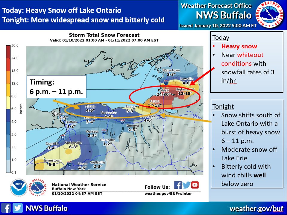
– Through the 9 o’clock hour a band of heavy snow will accompany a cold front dropping across Lake Ontario. Snowfall rates could exceed 1-2 inches per hour. However, this heavy snowfall will only last in any one location for an hour or two.
– Through the overnight hours lake effect bands will cross the region- dropping the heaviest snow in Cayuga, Wayne, Monroe, and parts of Northern Seneca counties in the Finger Lakes. Areas southeast of Lake Ontario in Central New York will also see heavy snowfall.
– Once the snow wraps up it will usher in the coldest night and day of the season so far. Wind chills will be well-below zero when you wake up in the morning. In fact, the National Weather Service has issued a Wind Chill Advisory because of it.
Check out the latest from the Storm Trackers Team by clicking here. Visit the FingerLakes1.com Weather Center for the latest forecast information, too.

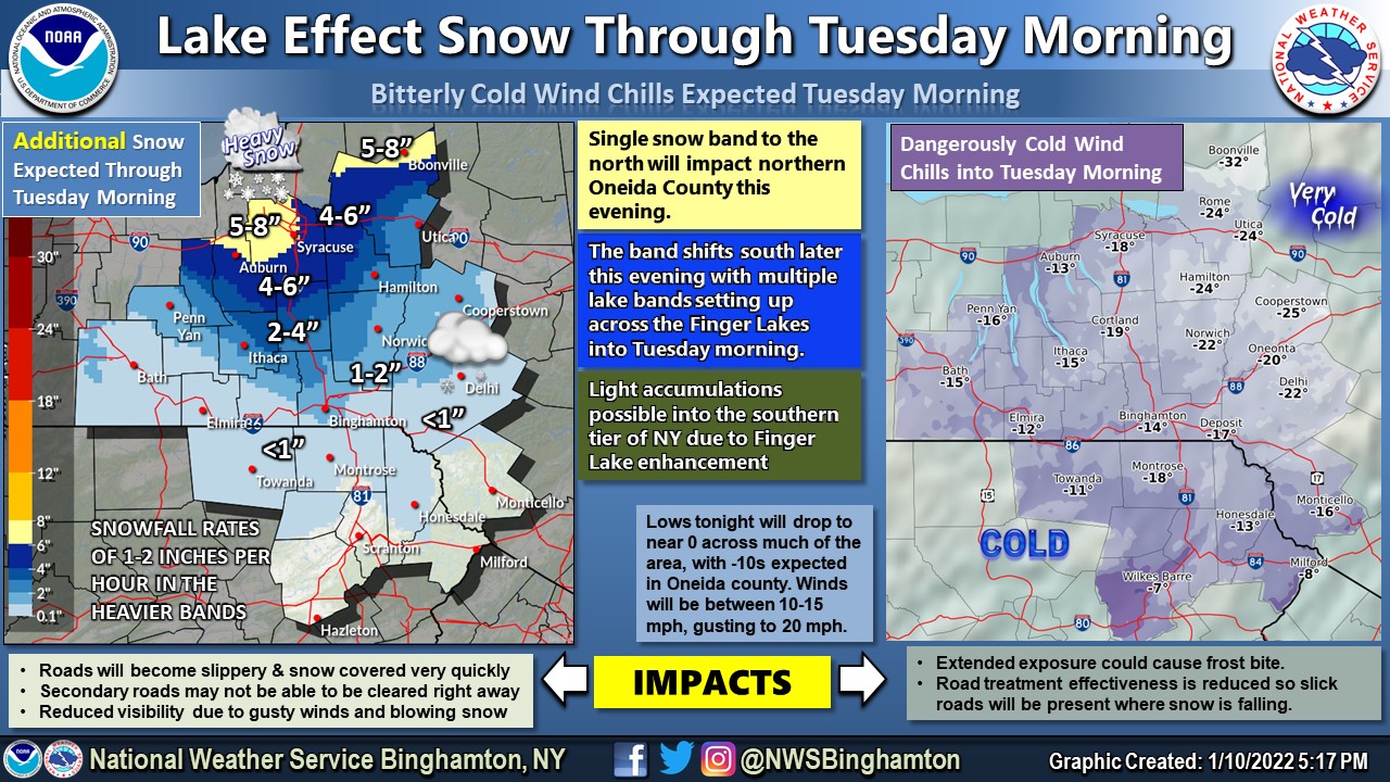

[5:40 PM EST] Intense LES band to the north nudging south this evening. This band is expected to impact the NY Thruway starting between 7-8 PM. Snowfall rates 1-2" per hour are likely for several hours. Thinner/weaker bands set up tonight across central NY as the cold air arrives pic.twitter.com/RTFZymkQqy
— NWS Binghamton (@NWSBinghamton) January 10, 2022
FingerLakes1.com is the region’s leading all-digital news publication. The company was founded in 1998 and has been keeping residents informed for more than two decades. Have a lead? Send it to [email protected].