


There’s going to be plenty of wintry weather over the next several days in the Finger Lakes and Central New York.
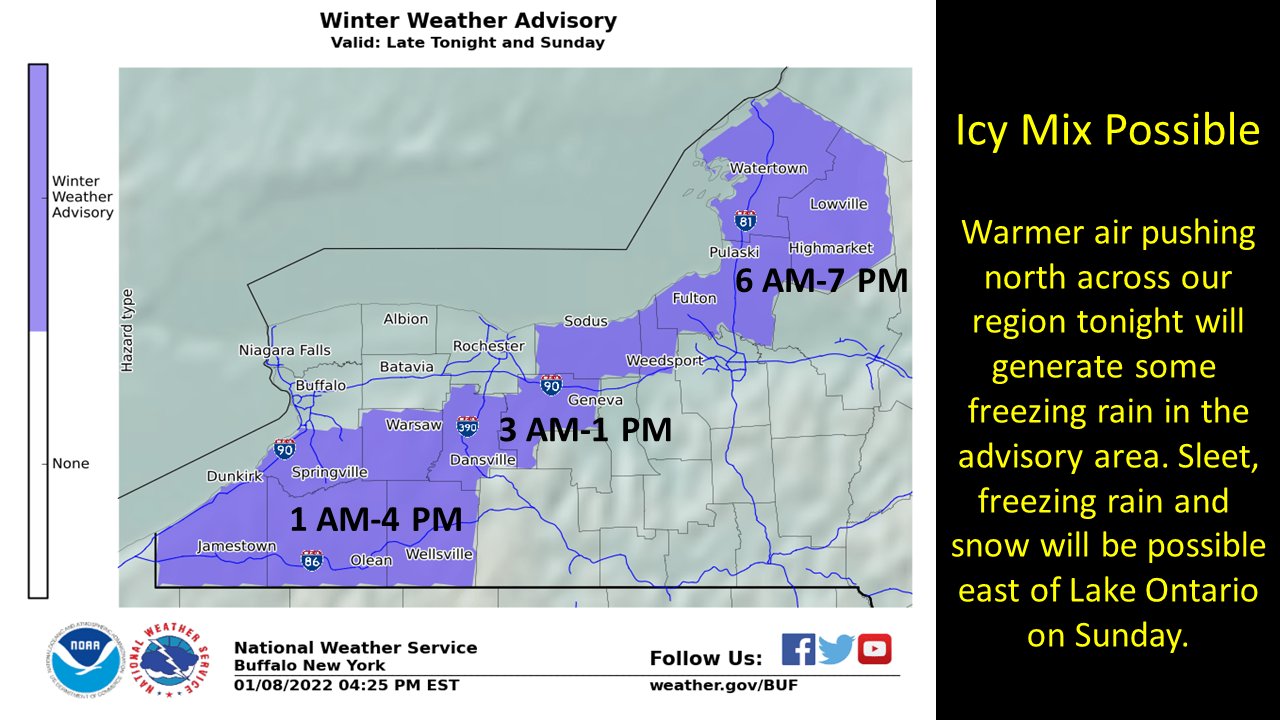
It starts today with the threat for icy precipitation during the morning and afternoon hours. While precipitation will be relatively light- it prompted the National Weather Service to issue a Winter Weather Advisory for almost the entire area.
– Counties included in the Winter Weather Advisory are: Cayuga, Ontario, Schuyler, Seneca, Steuben, Tompkins, Livingston, Cortland, Onondaga, Wayne, and Yates.
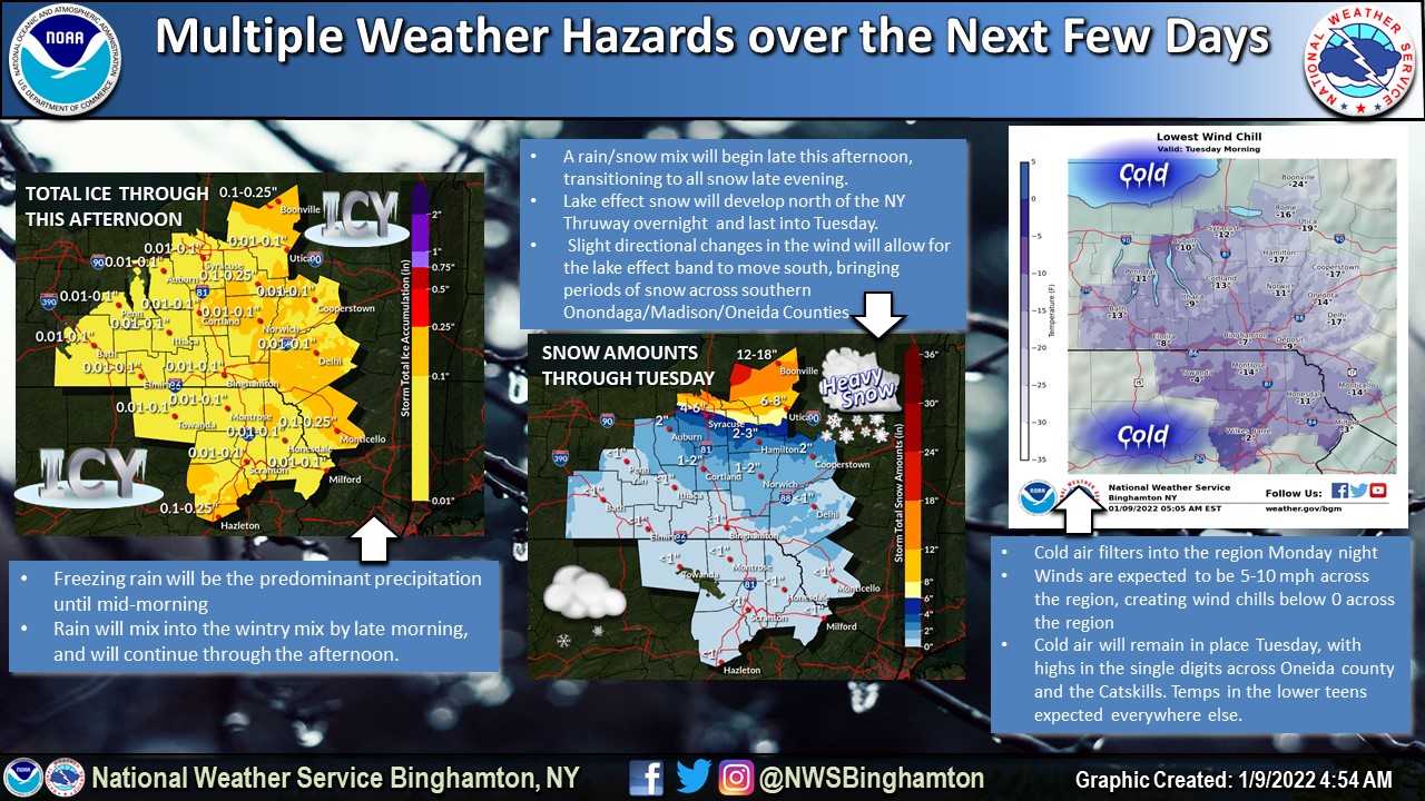
Once the freezing rain threat ends during the afternoon hours- that’s when a rain-snow mix will begin. It will transition to all snow by late this evening.
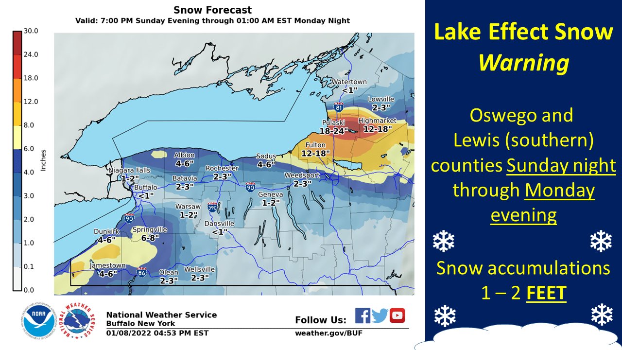
Lake effect snow will develop bringing snowy conditions to areas north of the Thruway. The heaviest snow will fall well north of the Thruway- but those traveling along the I-90 corridor should use caution tonight and Monday. Those areas well north of the Thruway will see some significant snowfall out of this lake effect event. Locations east of Lake Ontario could see upwards of 18 inches of snow.
By Monday evening some of the coldest air of the season will be overtaking the region. Wind chills are expected to crater by Tuesday morning- with many places waking up with sub-zero feeling conditions.
Air temperatures will drop into the single digits and a 5-10 mph wind during the overnight hours will be enough to drop the wind chill to -5 to -15 in spots.

Local Weather Graphics
Latest from National Weather Service
FingerLakes1.com is the region’s leading all-digital news publication. The company was founded in 1998 and has been keeping residents informed for more than two decades. Have a lead? Send it to [email protected].