


Remember those loud weather-related warnings people get on their smartphones during the winter when there’s a Snow Squall Warning?
Well, there’s one for the summer months, too. While those loud, blaring alerts have gone out for tornado warnings- a much more common occurrence will prompt an alert on the Wireless Emergency Alert system.
Effective immediately, severe thunderstorms that are deemed destructive will prompt that alert on smartphones.
What’s destructive? Any storm that has 2.75 inch diameter hail and/or 80 mph winds, according to the National Weather Service.
Here’s more on the announcement from the National Weather Service:
“Destructive” and “Considerable” Damage Threat Categories
We developed three categories of damage threat for Severe Thunderstorm Warnings. The categories, in order of highest to lowest damage threat, are destructive, considerable, and base. These tags and additional messaging are designed to promote immediate action, based on the threats.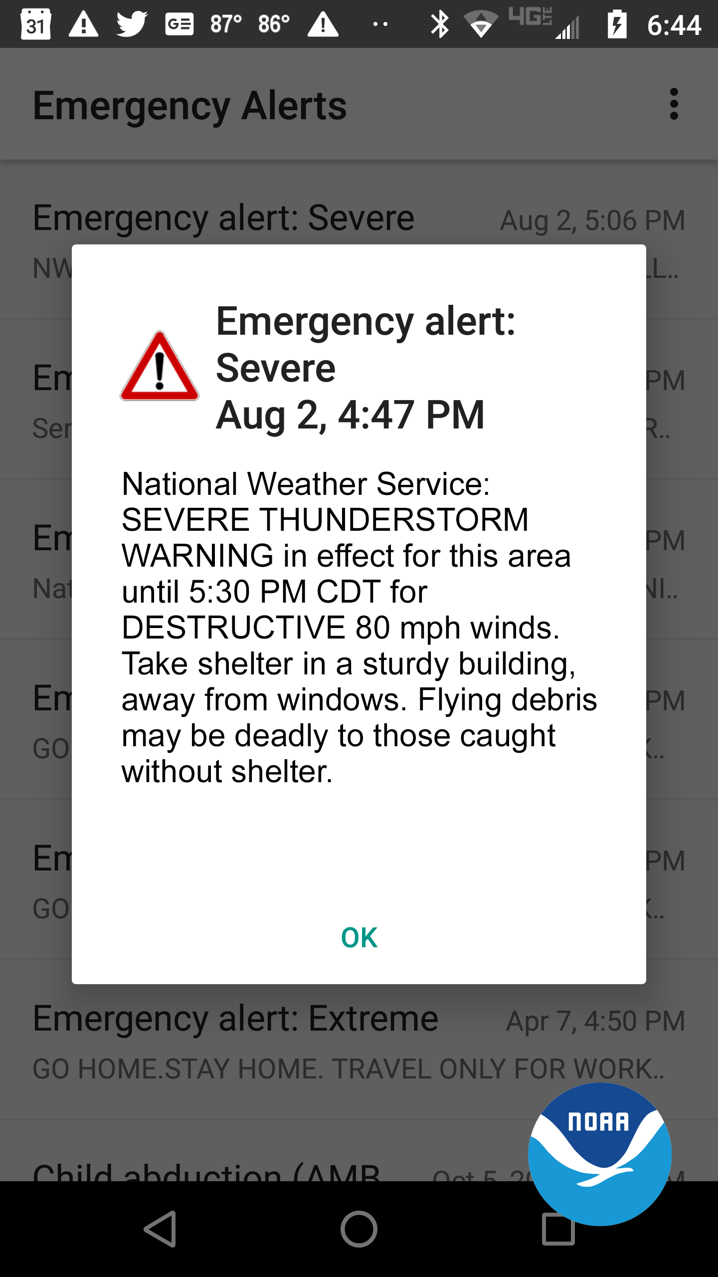
- The criteria for a destructive damage threat is at least 2.75 inch diameter (baseball-sized) hail and/or 80 mph thunderstorm winds. Warnings with this tag will automatically activate a Wireless Emergency Alert (WEA) on smartphones within the warned area.
- The criteria for a considerable damage threat is at least 1.75 inch diameter (golf ball-sized) hail and/or 70 mph thunderstorm winds. This will not activate a WEA.
- The criteria for a baseline or “base” severe thunderstorm warning remains unchanged, 1.00 inch (quarter-sized) hail and/or 58 mph thunderstorm winds. This will not activate a WEA. When no damage threat tag is present, damage is expected to be at the base level.
On average, only 10 percent of all severe thunderstorms reach the destructive category each year, nationwide. Most of these storms are damaging wind events such as derechoes and some of the larger, more intense thunderstorms, called “Supercell” storms that can typically produce very large hail in their path. The new destructive thunderstorm category conveys to the public urgent action is needed, a life-threatening event is occurring and may cause substantial damage to property. Storms categorized as destructive will trigger a WEA to your cell phone.
All National Weather Service Severe Thunderstorm Warnings will continue to be issued and distributed via weather.gov, NOAA Weather Radio, Emergency Alert System and through dissemination systems to our emergency managers and partners. The addition of damage threat tags are part of the broader Hazard Simplification Project to improve communication of watches and warnings to the public.
Thirteen of the 22 costliest weather disasters in 2020 were severe thunderstorms. The new “destructive” tag would have activated a Wireless Emergency Alert for many of these impactful events, including the costliest thunderstorm in U.S. history, the $11 billion derecho that affected Iowa in August 2020.
Learn how to stay safe in a severe thunderstorm. Knowing what to do before, during, and after severe weather can increase your chances of survival.
The NOAA Storm Prediction Center provides forecasts of severe weather up to seven days in advance, and severe thunderstorm and tornado watches several hours before storms form.
FingerLakes1.com is the region’s leading all-digital news publication. The company was founded in 1998 and has been keeping residents informed for more than two decades. Have a lead? Send it to [email protected].