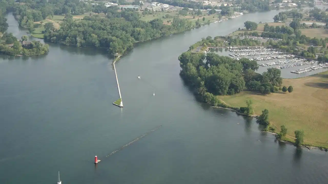
Ithaca's next major waterfront project could involve months of dredging, floating pipelines and temporary construction areas as New York works to restore space for floodwater and boats in Cayuga Inlet.
The Department of Environmental Conservation's project notice describes removing up to 206,043 cubic yards of sediment from Cayuga Inlet and Old Cayuga Inlet and pumping it to an existing upland facility for dewatering and storage.

DEC told Tompkins Weekly it expects dredging to begin in 2027 and is working with the Office of General Services on the bid-advertisement timeline, but did not disclose a current cost estimate before a contract award.
The newspaper reported that DEC issued the freshwater-wetlands permit and water-quality certification July 23.
The work is intended to improve flood protection and navigation, but it also has to accommodate rowing, boating, park access, sensitive wildlife and invasive Hydrilla in one of Ithaca's busiest outdoor corridors.
Why the channel needs dredging
The problem is not simply that boats have less room beneath their hulls: accumulated sediment also reduces the channel's ability to carry floodwater through the city.
A U.S. Geological Survey study says the Army Corps of Engineers built the flood-control channel between 1965 and 1970, and infrequent maintenance allowed shoaling to substantially reduce its flood-flow and navigation capacity.
The agency surveyed water depths in July 2016 with an acoustic Doppler current profiler to help governments evaluate maintenance needs; the current state design separately identifies a September 2024 bathymetric survey as part of its engineering basis.
The final design calls for 180,374 cubic yards of removal in the planned dredge area, rising to as much as 206,043 cubic yards with a permitted 6-inch overdepth, according to Tompkins Weekly's account of the application.
The dredging footprint covers about 31.6 acres along approximately 1.9 miles of Cayuga Inlet and Old Cayuga Inlet, within a wider project corridor of roughly 2.8 miles that also includes pipes, staging and sediment handling.
At some locations, removal could lower the existing sediment surface by up to 11 feet.
The state divided the effort between roughly 100,000 cubic yards emphasizing flood protection and a similar amount supported by the Canal Corp. to improve navigation, rather than proceeding with older concepts contemplating about 600,000 cubic yards.
The roughly 9.5-acre sediment-management facility, designed to hold about 200,000 cubic yards, is one constraint on that scope.
How sediment will leave the water
The state's January 2026 design drawings show a pipeline-and-pumping system connecting the inlet work areas to the sediment-management facility near the western end of Fairgrounds Memorial Parkway.
Hydraulic dredging suctions sediment into a mixture of water and solids, then sends it through pipe instead of relying on a stream of trucks to carry wet material directly from the channel.
The application described by Tompkins Weekly anticipates slurry containing about 10% solids, with pipeline length changing as the dredge moves — from about 6,210 feet to 14,661 feet, including as much as 11,901 feet floating on the water at once.
Up to three booster pumps could assist the transfer, with equipment at staging areas or on a small barge.
At the facility, large geotextile tubes will retain sediment while allowing water to drain into a lined and bermed containment area, then through a stormwater swale toward the relief channel.
The state drawings show the filled tubes remaining after construction, as well as removal of temporary facilities and restoration of disturbed ground; pumping the sediment out is not the same as completing its eventual disposal.
Boating will continue around an active work zone
DEC told Tompkins Weekly it has coordinated with recreational boating and rowing groups and expects navigation to and from Cayuga Lake to remain open.
Nonmotorized boats are also expected to retain access along the flood-control channel and the lower portions of Six Mile, Cascadilla and Fall creeks, but boats will be excluded from active dredging areas and their turbidity curtains.
The contractor will need to coordinate with marina traffic, provide advance notices and navigation aids, and arrange vessel passage when necessary to limit blockages.
That matters for a corridor used by Cornell and Ithaca College rowers, dragon boat teams, paddlers, anglers, boat tours and motorboats; the application identifies 657 motorized slips serving it during the April-to-October boating season.
Proposed hours are 7 a.m. to 5 p.m. Monday through Saturday, with an estimated 171 to 274 actual dredging workdays depending on production, according to the application details reported by Tompkins Weekly.
Trails and parks will have temporary changes
Three staging areas will bring equipment onto the waterfront: about 1.479 acres near Six Mile Creek, 0.279 acre near the boat houses and 0.810 acre at Cass Park.
The boat-house area will require closing part of the waterfront walking trail and providing a pedestrian detour, while the Cass Park staging area will occupy a fenced section east of the Cayuga Waterfront Trail without closing access to the rest of the park, Tompkins Weekly reported.
The state design also requires protection of outfalls, utility crossings and bridges, and specifies construction-access signs, trail-crossing protection and restoration of affected areas.
The project notice says temporary wetland and adjacent-area impacts from staging and pipelines must be restored when work is complete.
Water quality, wildlife and Hydrilla need separate protections
The project is planned in a system already affected by sediment, phosphorus and aquatic weed growth, with Cayuga Lake also serving as a drinking-water source.
DEC determined the project would not have a significant environmental effect after coordinated state environmental review.
Turbidity curtains around the immediate work area are intended to limit the spread of disturbed sediment; the design requires lighted markers and signs and daily inspection of the curtain at the relief-channel discharge.
The application acknowledges that disturbing the bottom can destroy or draw in bottom-dwelling organisms, fish and eggs, while a Lake Sturgeon Avoidance Plan calls for barriers and scheduling protections near the inlet mouth, according to Tompkins Weekly.
Most sediment was described by DEC as Class A, with no appreciable contamination, but three historical Class B locations indicate slight to moderate chemical contamination and will require attention during removal.
Older sampling detected substances including mercury, cadmium, copper, lead, PCBs and polycyclic aromatic hydrocarbons in some samples; that does not mean all dredged sediment has those concentrations.
The reported contingency plan calls for separating and further testing material with unusual color or strong odors.
The application estimates dewatering discharge averaging about 2,355 gallons per minute, with daily volumes of roughly 869,000 to 1.39 million gallons depending on operating conditions, according to Tompkins Weekly.
The permit also requires testing the dewatering discharge for toxicity because chemicals used to separate solids and water can affect aquatic life.
If permit action levels are exceeded, the operator must take corrective action and notify DEC within 24 hours; unresolved turbidity or suspended-sediment problems require stopping the discharge until DEC approves a remedy, Tompkins Weekly reported.
The plans call for pausing dredging during significant rainfall so water can be held at the facility rather than adding to flood conditions.
Hydrilla adds a longer-term complication: the invasive plant can survive for more than four years, so the material will remain in light-blocking geotextile tubes for years rather than immediately becoming reusable soil.
The reported design includes a 3-millimeter screen near the filtrate discharge to keep plant fragments from escaping, alongside the hydraulic-removal system and curtains.
The final price and disposal plan are different questions
DEC and the Canal Corp. are funding the dredging, but the current construction total has not been disclosed; DEC told Tompkins Weekly it would not provide that figure before the project is awarded.
The newspaper reported that DEC identified $5.8 million available in March 2023 and estimated needing another $12 million to maximize the facility's capacity — an approximately $17.8 million funding picture at that time, not a current bid price.
A separate $3.765 million facility-construction contract awarded in 2019 covered the sediment site, not the upcoming dredging operation, while a 2015 Hydrilla plan's $13 million funding reference and a $2 million appropriation from 2008 concern different stages of a long-running effort rather than amounts that should be added together as today's price.
After dewatering, the city will own the sediment and be responsible for eventual disposal or beneficial reuse under a DEC-approved plan, work outside the present dredging contract.
The next practical milestones are the state's bid schedule and contract award, followed by a construction timetable and boating and trail-access notices that tell waterfront users when the planned disruptions will begin.

FingerLakes1.com is the region’s leading all-digital news publication. The company was founded in 1998 and has been keeping residents informed for more than two decades. Have a lead? Send it to news@fingerlakes1.com.