


It starts out chilly this morning, but temperatures will quickly jump – some 30 degrees over the next 4-5 hours – heating up the atmosphere and setting the stage for severe weather.

The National Weather Service and Storm Prediction Center places most of the Finger Lakes region in a ‘slight risk’ category, which is higher than the region typically sees.
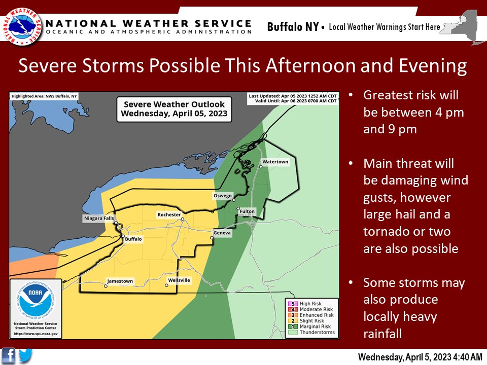
The main threat with thunderstorms that develop this afternoon will be damaging wind gusts and large hail. However, forecasters and meteorologists have been quick to also note that they cannot rule out an isolated tornado or two where storms develop.
This is because of the atmospheric conditions, which will be primed development. The period of time with the highest risk factor for thunderstorms with damaging winds will be between 2 p.m. and 9 p.m.
These storms will work from the west-to-east.
Radar
Latest from NWS
A Twitter List by JoshDursoFingerLakes1.com is the region’s leading all-digital news publication. The company was founded in 1998 and has been keeping residents informed for more than two decades. Have a lead? Send it to [email protected].