

The lake effect snow bands that are making travel difficult during the early-morning hours will dissipate as time goes on.
Use caution on roadways, especially if traveling along the Route 104 corridor between Monroe, Wayne, and Cayuga counties. That’s where the heaviest snow fell overnight.
Parts of the New York State Thruway are still seeing bursts of snow. Areas south of Rochester and east of Exit 40 are the biggest concern.
The Winter Weather Advisory issued by the National Weather Service will expire later this morning.
- Looking for your Thanksgiving forecast? Check out the FingerLakes1.com Weather Center.
Here’s a look at what to expect for the rest of the day:
Yellow Alert for local lake snows this morning. Live updates on First Alert Radar starting at 430am on News10NBC Today. Looking ahead to nicer weather tomorrow and a mild Thanksgiving Day. More Lake snow Fri-Sat in the 10Day. pic.twitter.com/Fqw2lSyULN
— news10nbc (@news10nbc) November 23, 2021
#roc @SPECNews1ROC pic.twitter.com/5yzTYgp2uB
— scott barstow (@barstow_scott) November 23, 2021

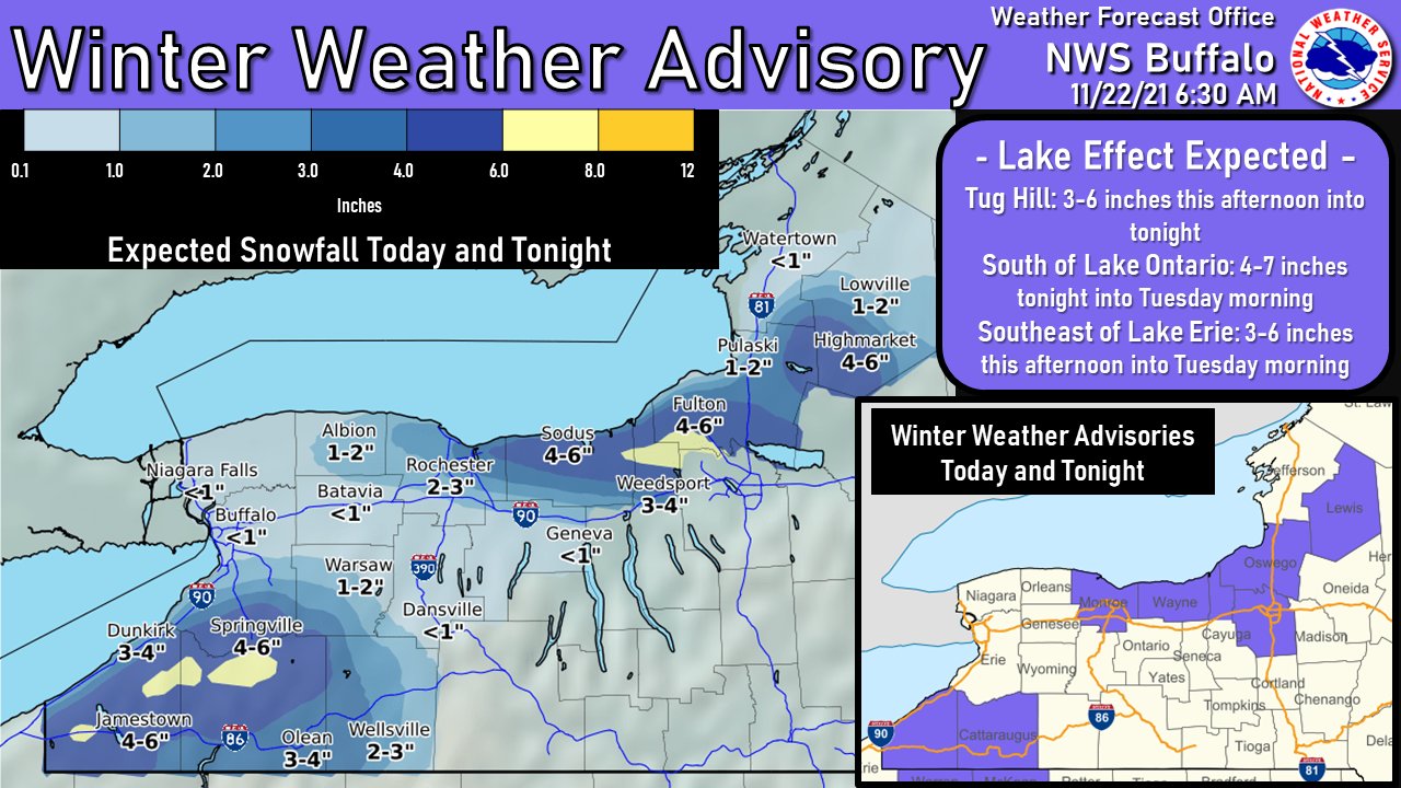
Here’s a look at what was forecasted for Western New York:
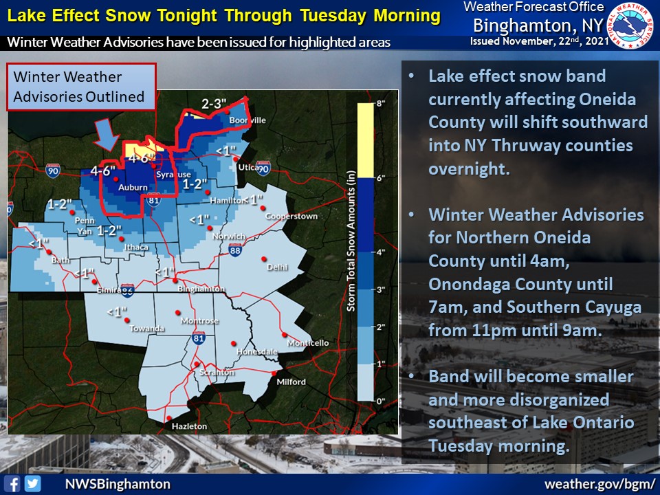
Here’s a look at what was forecasted for the Southern Tier:
The latest from the National Weather Service:
FingerLakes1.com is the region’s leading all-digital news publication. The company was founded in 1998 and has been keeping residents informed for more than two decades. Have a lead? Send it to [email protected].