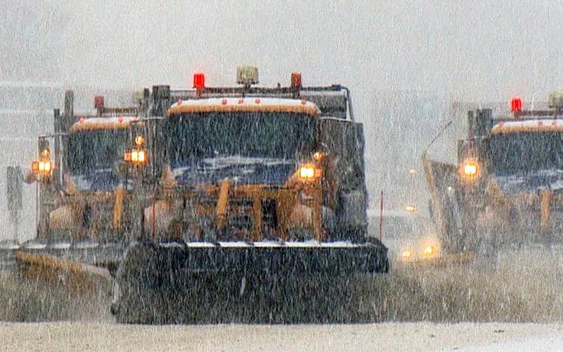
A fast-moving clipper system is driving a widespread round of snow, mixed precipitation and gusty winds across the Finger Lakes, Central New York, Western New York and the Southern Tier on Wednesday, setting the stage for a prolonged period of lake effect snow and well-below-average temperatures through the weekend, according to the National Weather Service.

Snow developed early Wednesday morning and will transition to a mix of rain and snow at lower elevations through the midday and afternoon hours, especially near the Lake Erie shoreline and in some valley locations. Behind a sharp cold front Wednesday evening, temperatures will quickly fall back below freezing, changing precipitation to all snow and kicking off multiple bands of lake effect snow that are expected to persist into Thursday and Friday.

High temperatures Wednesday are expected to reach the upper 30s to near 40 degrees before plunging into the 20s overnight as west and northwest winds strengthen.
Active winter warnings and advisories for Wednesday
A large portion of New York and northern Pennsylvania remains under winter storm warnings, winter storm watches and winter weather advisories as of Wednesday morning.
Winter storm warnings are in effect through early Thursday for:
- Oswego, Jefferson and Lewis counties, where 8 to 16 inches of snow are expected over higher terrain, with 3 to 6 inches in surrounding lowlands.
- Northern Oneida County, where 6 to 12 inches of snow are forecast along with wind gusts up to 30 mph.
- Northern Herkimer, Hamilton and Northern Fulton counties, where 7 to 12 inches are expected, with isolated totals of 12 to 14 inches in parts of the Adirondacks.
In northwestern Pennsylvania, southern Erie County is under a winter storm warning through early Friday, with 8 to 10 inches expected and locally higher totals up to 14 inches in persistent lake effect bands.
Winter weather advisories cover much of the rest of Central New York, the Finger Lakes, Western New York and the Northern Tier and Southern Tier of Pennsylvania. These areas can expect:
- Snow accumulations of 1 to 5 inches Wednesday in most locations.
- Higher localized amounts of up to 7 inches in elevated terrain.
- Brief periods of freezing rain and light icing possible in parts of northeast Pennsylvania, including the Wyoming Valley.
- Slippery road conditions during both the morning and evening commutes.
Winter storm watches are also in effect from late Wednesday night through Friday morning for:
- Wayne and Northern Cayuga counties.
- Onondaga, Madison and Southern Oneida counties.
These areas could see 7 inches or more of heavy lake effect snow, accompanied by strong winds that may produce blowing and drifting snow.
Motorists are urged to check road conditions via 511 before traveling and to be prepared for rapidly changing visibility within lake effect bands.
Today: Snow changes to rain, then back to snow
Snow will dominate the morning hours Wednesday across most of the region as temperatures remain below freezing aloft. By late morning into early afternoon, warmer air will allow snow to mix with or change to rain in lower elevations, particularly:
- Along the Lake Erie shoreline.
- In some valley locations across the Southern Tier and northeast Pennsylvania.
Higher elevations will hold onto mostly snow through the day. By early evening, a strong cold front will sweep west to east across the region, shifting winds to the west and northwest and forcing temperatures back below freezing. Any rain or mixed precipitation will quickly flip back to snow, with a fresh coating expected overnight.
Wind gusts of 25 to 35 mph will develop behind the front, producing areas of blowing snow and sharply reduced visibility.
Tomorrow and Friday: Lake effect snow and bitter cold
The most persistent and potentially disruptive snowfall of this pattern is expected from Thursday into early Friday as deep cold air pours across the Great Lakes.
Temperatures at higher elevations of the atmosphere will fall to around 15 degrees below zero Celsius by Thursday afternoon, creating ideal conditions for efficient lake effect snow production. Snowbands are expected to set up southeast of both Lake Erie and Lake Ontario.
Lake Erie snow targets:
- Southern Erie County
- Northern Chautauqua County
- Northern Cattaraugus County
These areas could see an additional 8 to 11 inches of snow Thursday into early Friday, with 4 to 6 inches for upslope areas of the Chautauqua Ridge.
Lake Ontario snow targets:
- Wayne County
- Northern Cayuga County
- Tug Hill region
Moderate to locally heavy accumulations are expected, with 7 to 9 inches possible in the most persistent bands.
Thursday will be windy and sharply colder, with gusts of 30 to 40 mph producing blowing and drifting snow. High temperatures will struggle to reach the mid-20s across much of Central New York and the Finger Lakes.
Snow showers and flurries will linger into Friday, with highs remaining in the upper 20s.

Weekend outlook: Cold, unsettled, continued snow chances
The active weather pattern continues into the weekend as another clipper system is projected to move through on Saturday. This system could deliver another round of accumulating snow, followed by renewed lake effect activity as arctic air deepens behind it.
From Saturday through Monday:
- Daily high temperatures will remain in the low to mid-20s.
- Overnight lows will dip into the teens.
- Periodic snow showers remain likely, with lake effect snow continuing downwind of both lakes.
Forecast confidence drops somewhat by early next week, but long-range guidance suggests temperatures will remain below average through at least Tuesday, with only modest moderation possible by midweek.
Travel impacts and safety concerns
Travel conditions will be challenging at times from Wednesday through Friday due to:
- Rapid snowfall rates within lake effect bands.
- Blowing and drifting snow from strong northwest winds.
- Repeated freeze-thaw cycles leading to icy pavement.
Air travel may also be affected at times due to low ceilings and reduced visibility in snow. Marine interests on Lakes Erie and Ontario face extended small craft advisories and gale warnings through Thursday due to strong winds and rough waters.
Drivers are advised to carry emergency supplies, slow down, and allow extra time for travel as winter weather impacts continue across the region through the end of the week.

FingerLakes1.com is the region’s leading all-digital news publication. The company was founded in 1998 and has been keeping residents informed for more than two decades. Have a lead? Send it to news@fingerlakes1.com.